HOME

Ciudad Estratificada Los Roferos

Ciudad Estratificada Los Roferos

Carretera Los RoferosTinajoLanzarote,   Spain

Ciudad Estratificada Los Roferos is a unique site in Lanzarote, showcasing multiple layers of geological or archaeological history. This site offers visitors a glimpse into the island's ancient past, with visible strata representing different periods of natural and human activity in the Los Roferos area./span>
Montaña de Guenia
Montaña de Guenia ‐ photo by ,
©www.mgaylard.co.uk.
a barren, rocky landscape
a barren, rocky landscape ‐ photo by ,
©www.mgaylard.co.uk.
a large, weathered rock formation in a rocky, arid landscape
a large, weathered rock formation in a rocky, arid landscape ‐ photo by ,
©www.mgaylard.co.uk.
The image depicts a rugged, barren landscape with rocky terrain and sparse vegetation. In the background, there are hills or small mountains under a clear blue sky. A lone utility pole stands in the distance, indicating some human presence in this otherwise natural and desolate area.
a rugged, barren landscape with rocky terrain and sparse vegetation. ‐ photo by ,
©www.mgaylard.co.uk.
a rocky, barren landscape with scattered vegetation under a clear blue sky
a rocky, barren landscape with scattered vegetation under a clear blue sky ‐ photo by ,
©www.mgaylard.co.uk.
A dirt road winds through the terrain, with several off-road vehicles traveling along it
A dirt road winds through the terrain, with several off-road vehicles traveling along it ‐ photo by ,
©www.mgaylard.co.uk.
View of estratificada ‐ photo by ,
©www.mgaylard.co.uk.
stratified rock formations
stratified rock formations ‐ photo by ,
©www.mgaylard.co.uk.
a prominent cliff formatio
a prominent cliff formatio ‐ photo by ,
©www.mgaylard.co.uk.
a prominent rock formation in the foreground
a prominent rock formation in the foreground ‐ photo by ,
©www.mgaylard.co.uk.
The image depicts a rugged, rocky landscape with a clear blue sky overhead. The terrain is characterized by large, jagged rocks and sparse vegetation, suggesting a harsh, arid environment. The scene is likely a natural, remote area with minimal human presence.
remote area with minimal human presence ‐ photo by ,
©www.mgaylard.co.uk.
Utility Task Vehicles ‐ photo by ,
©www.mgaylard.co.uk.
off-road vehicles, specifically Polaris Rangers
off-road vehicles, specifically Polaris Rangers ‐ photo by ,
©www.mgaylard.co.uk.
uneven terrain with large rocks and boulders scattered across it.
uneven terrain with large rocks and boulders scattered across it. ‐ photo by ,
©www.mgaylard.co.uk.
a rugged, rocky landscape with a dirt path winding through it
a rugged, rocky landscape with a dirt path winding through it ‐ photo by ,
©www.mgaylard.co.uk.
a rocky hillside
a rocky hillside ‐ photo by ,
©www.mgaylard.co.uk.
The image depicts a unique rock formation in a desert-like environment. The central feature is a tall, narrow rock pillar with a rough, textured surface, standing prominently against a clear blue sky. The surrounding area consists of rugged, rocky terrain with various rock formations and sparse vegetation. The overall scene suggests an arid, possibly volcanic landscape.
a unique rock formation in a desert-like environment. ‐ photo by ,
©www.mgaylard.co.uk.
natural rock formation
natural rock formation ‐ photo by ,
©www.mgaylard.co.uk.
uneven, rocky surfaces and formations
uneven, rocky surfaces and formations ‐ photo by ,
©www.mgaylard.co.uk.
The rocks are tall, irregularly shaped, and scattered across the ground
The rocks are tall, irregularly shaped, and scattered across the ground ‐ photo by ,
©www.mgaylard.co.uk.
scattered stones
scattered stones ‐ photo by ,
©www.mgaylard.co.uk.

Ciudad Estratificada (Los Roferos)

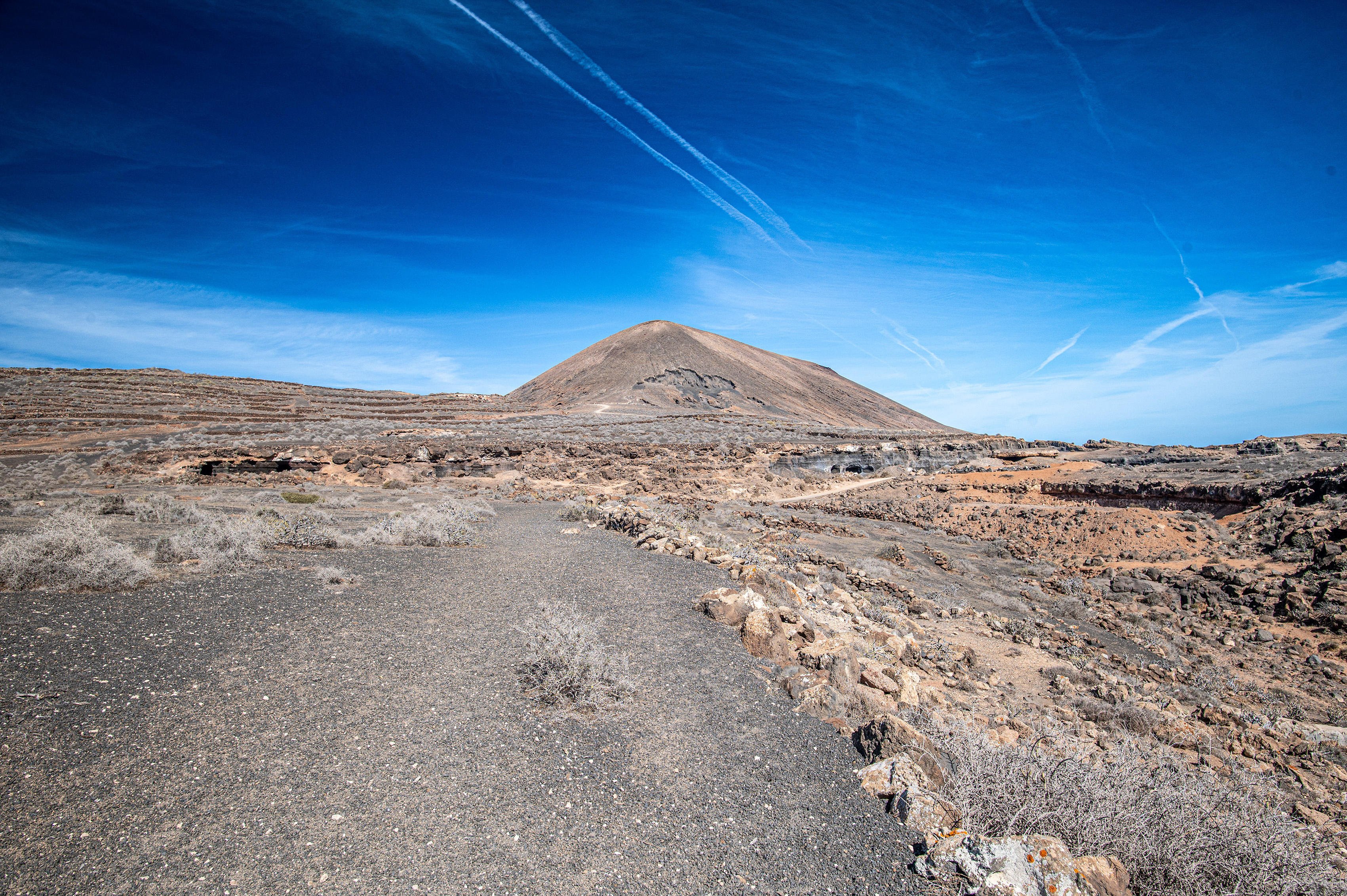
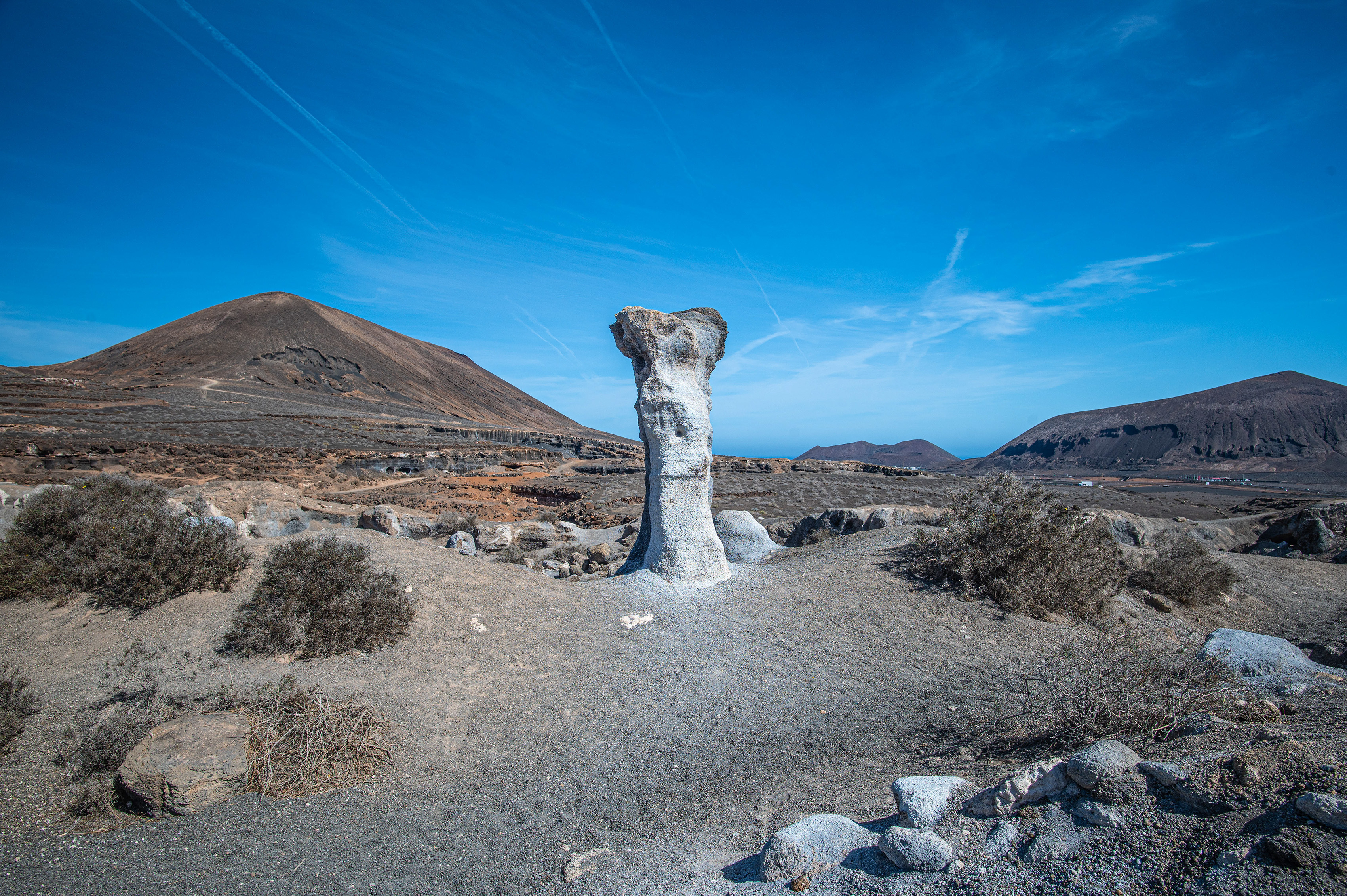
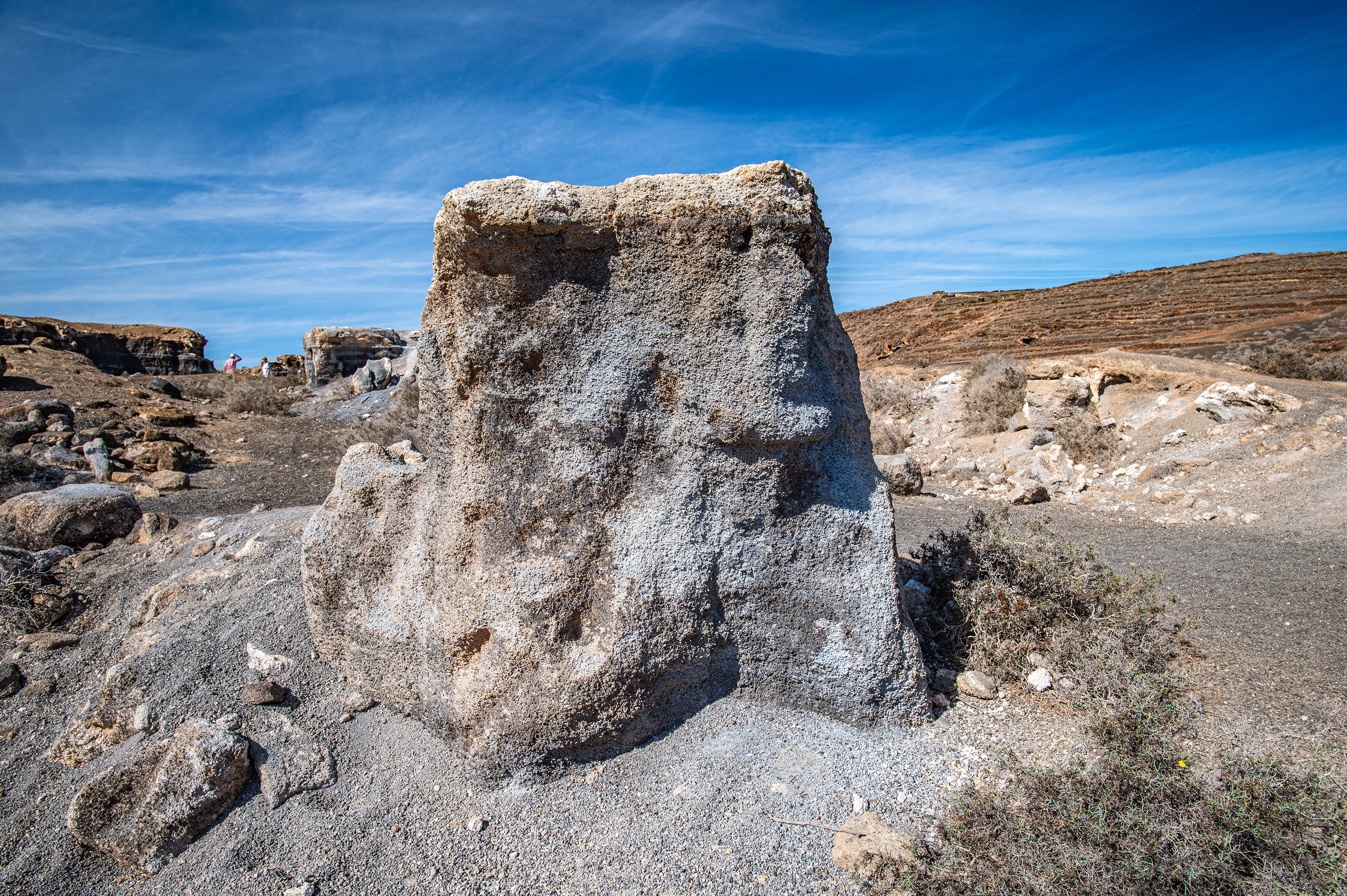
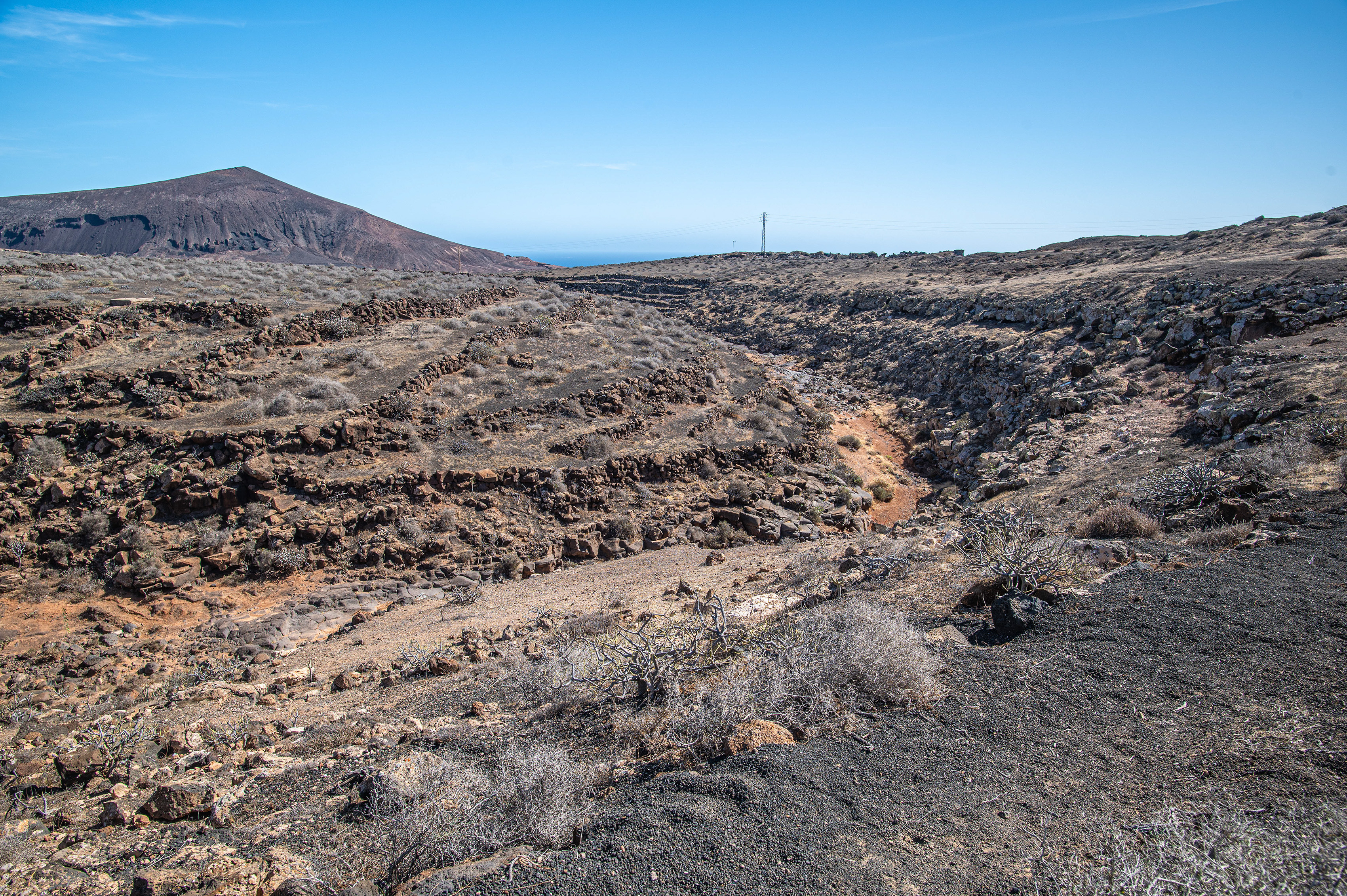
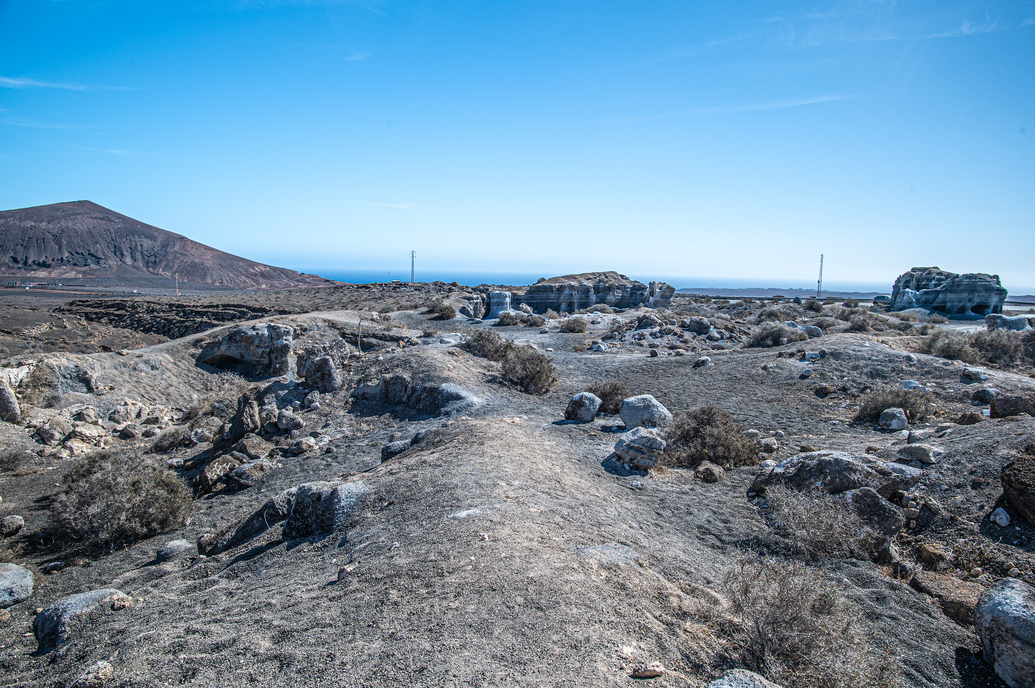
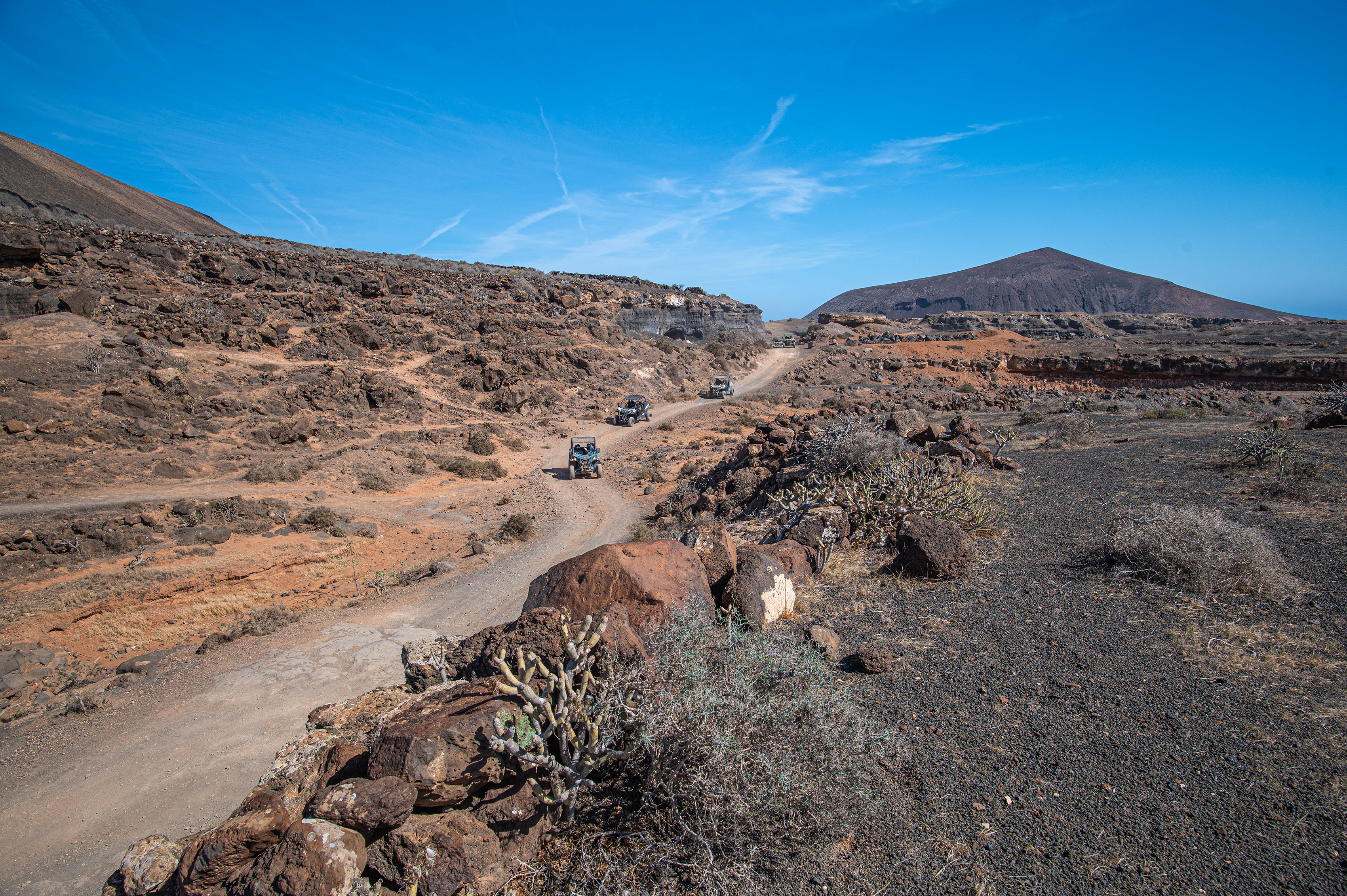
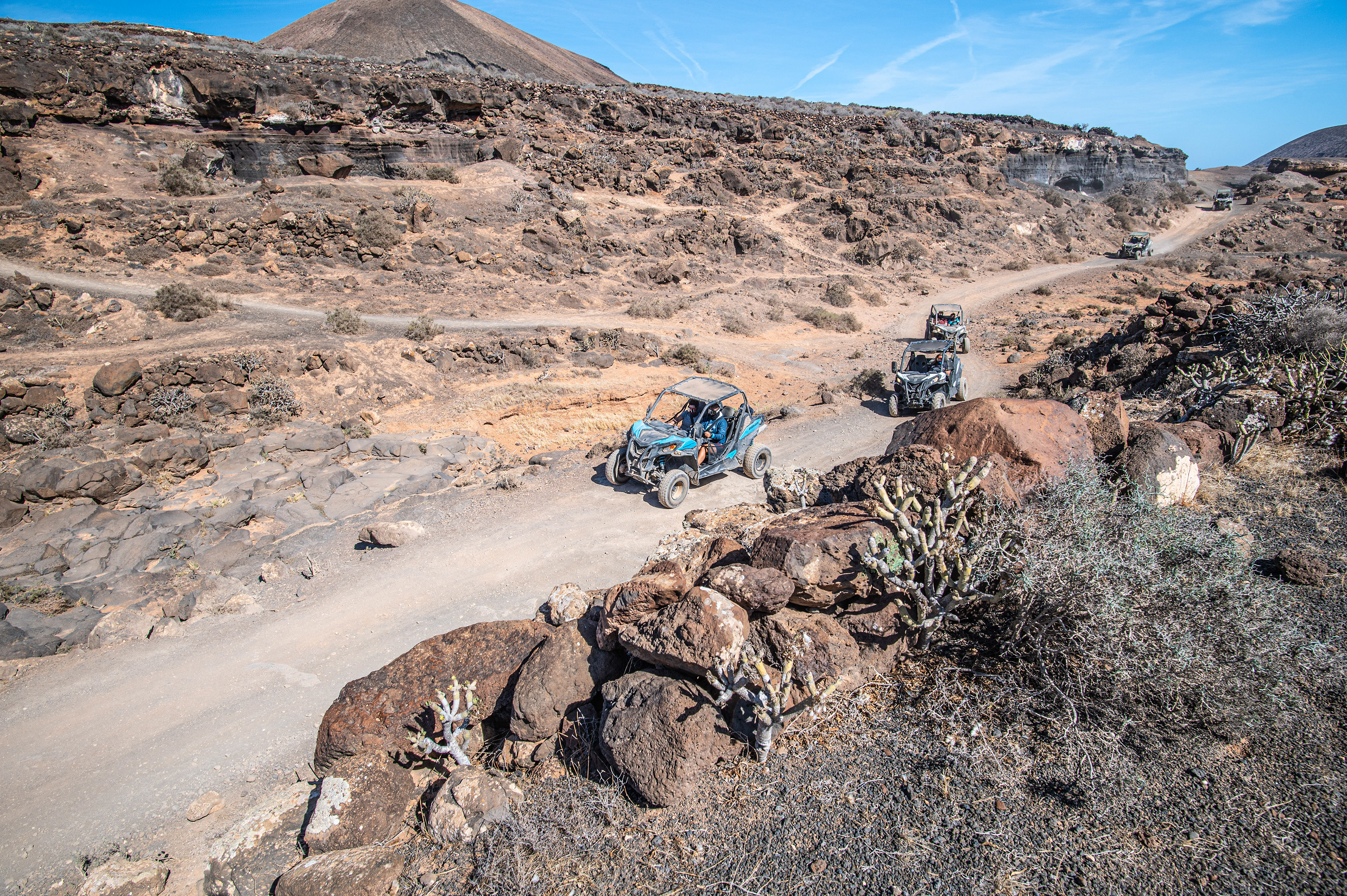
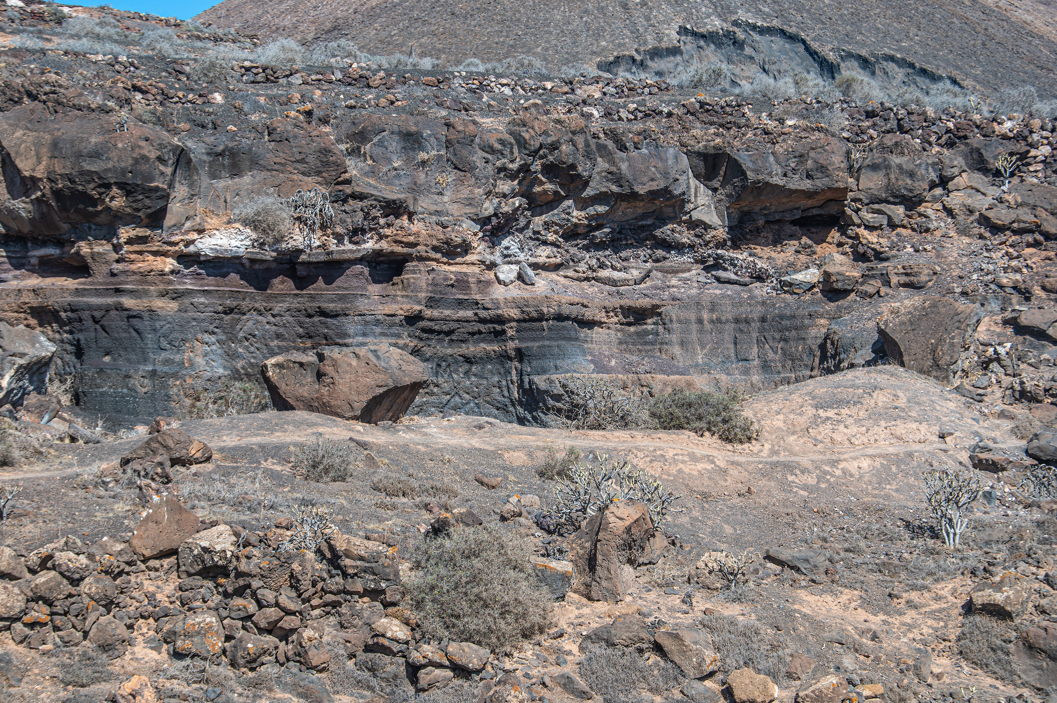
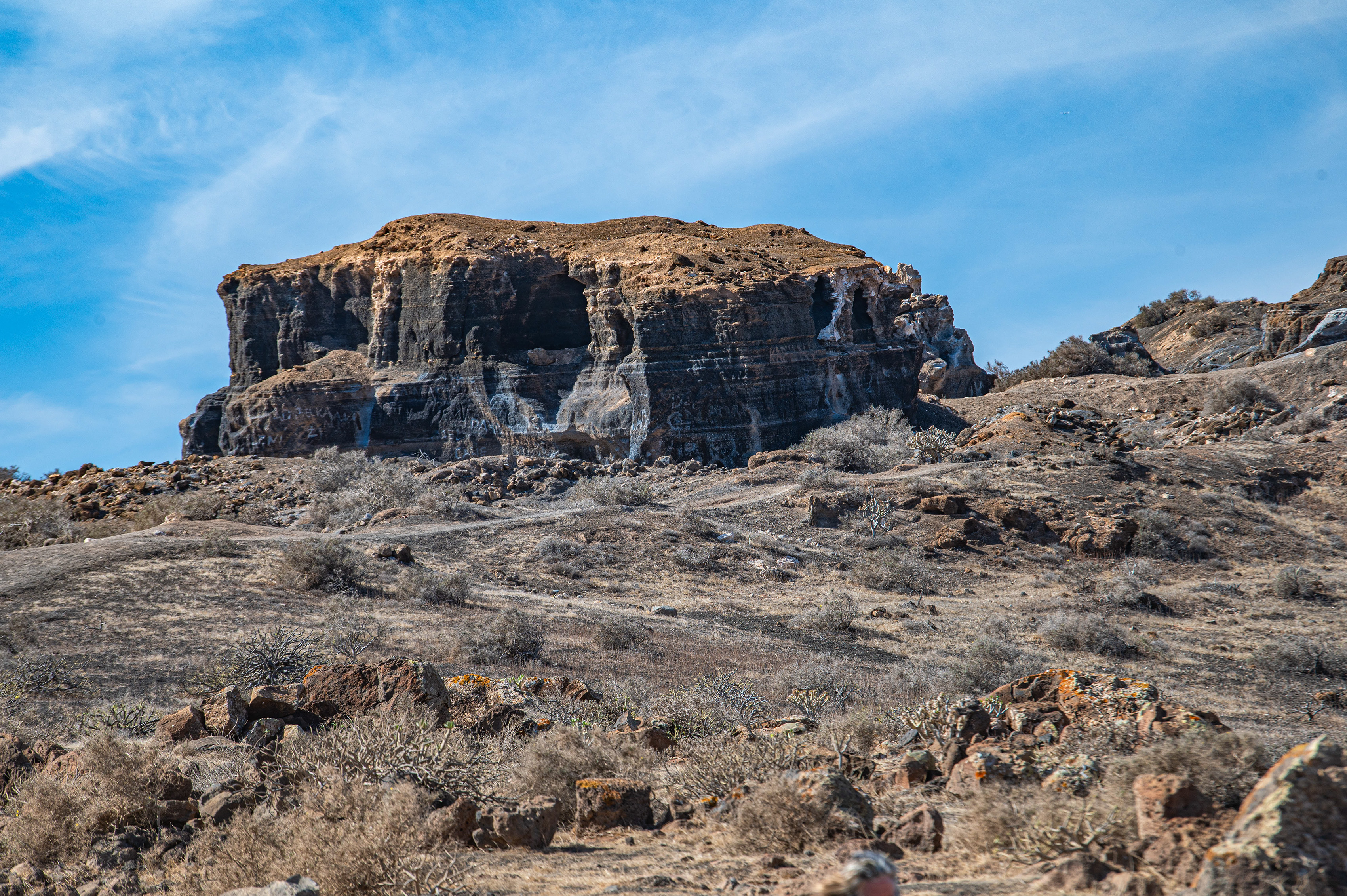
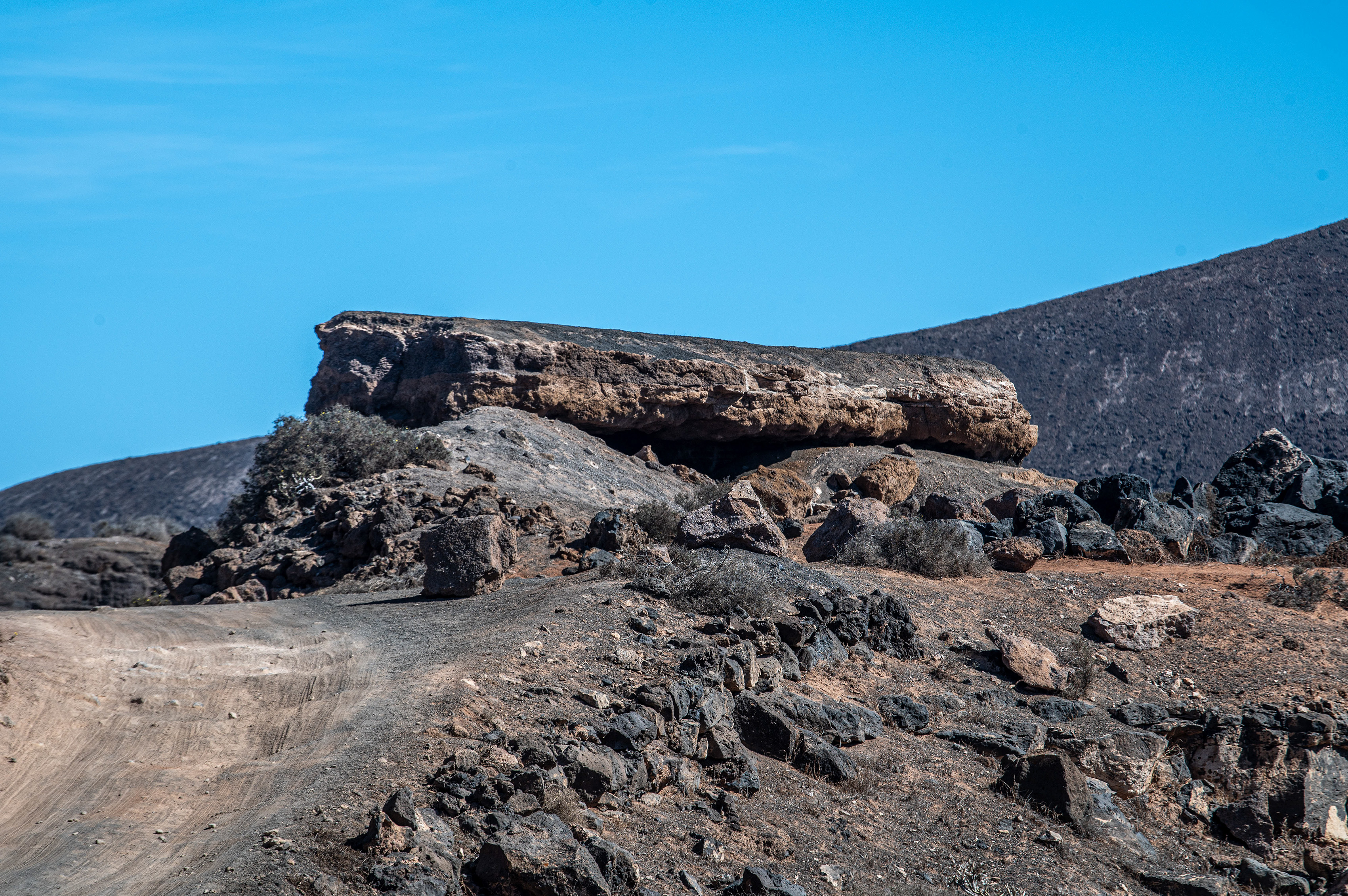
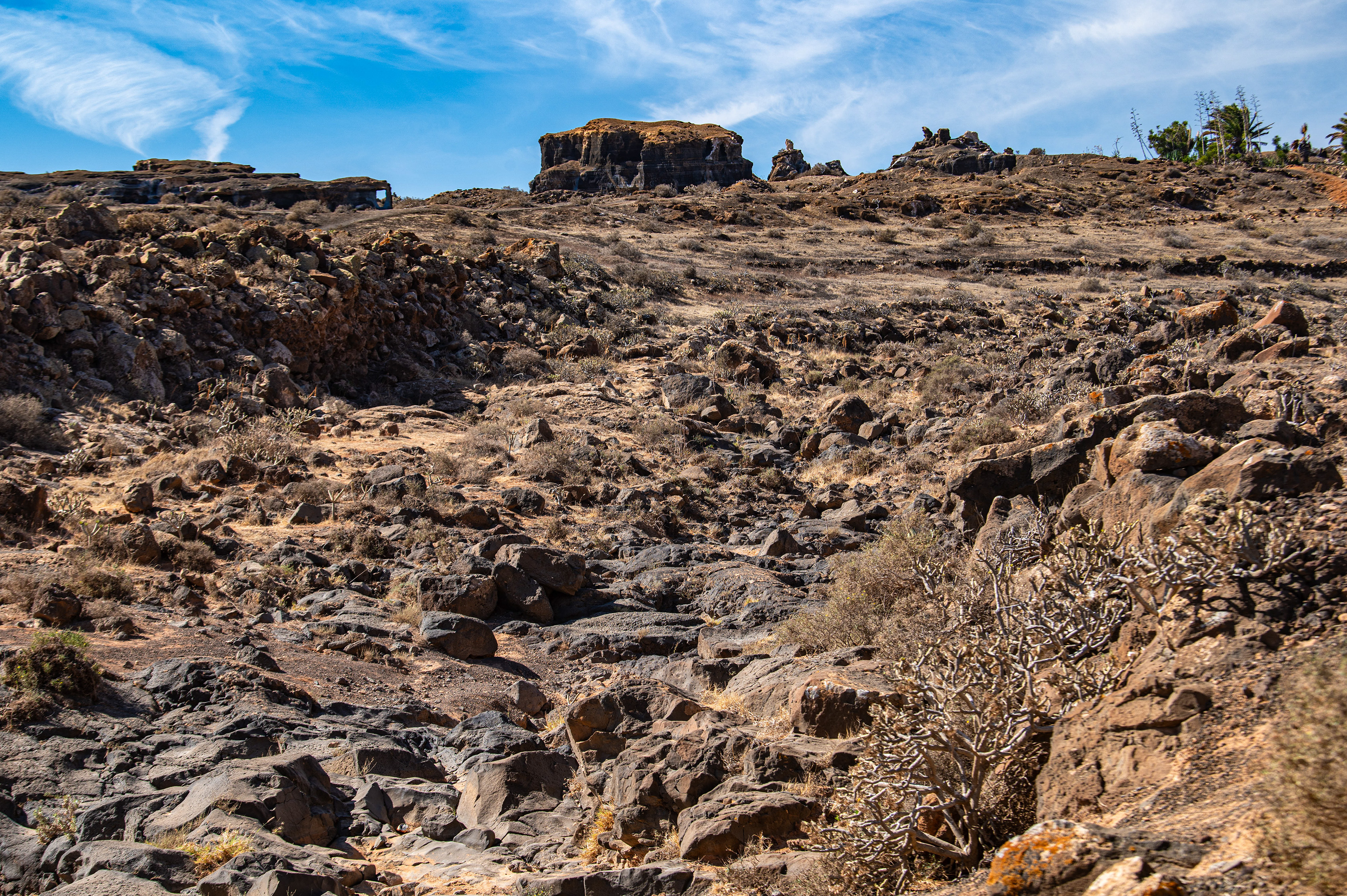
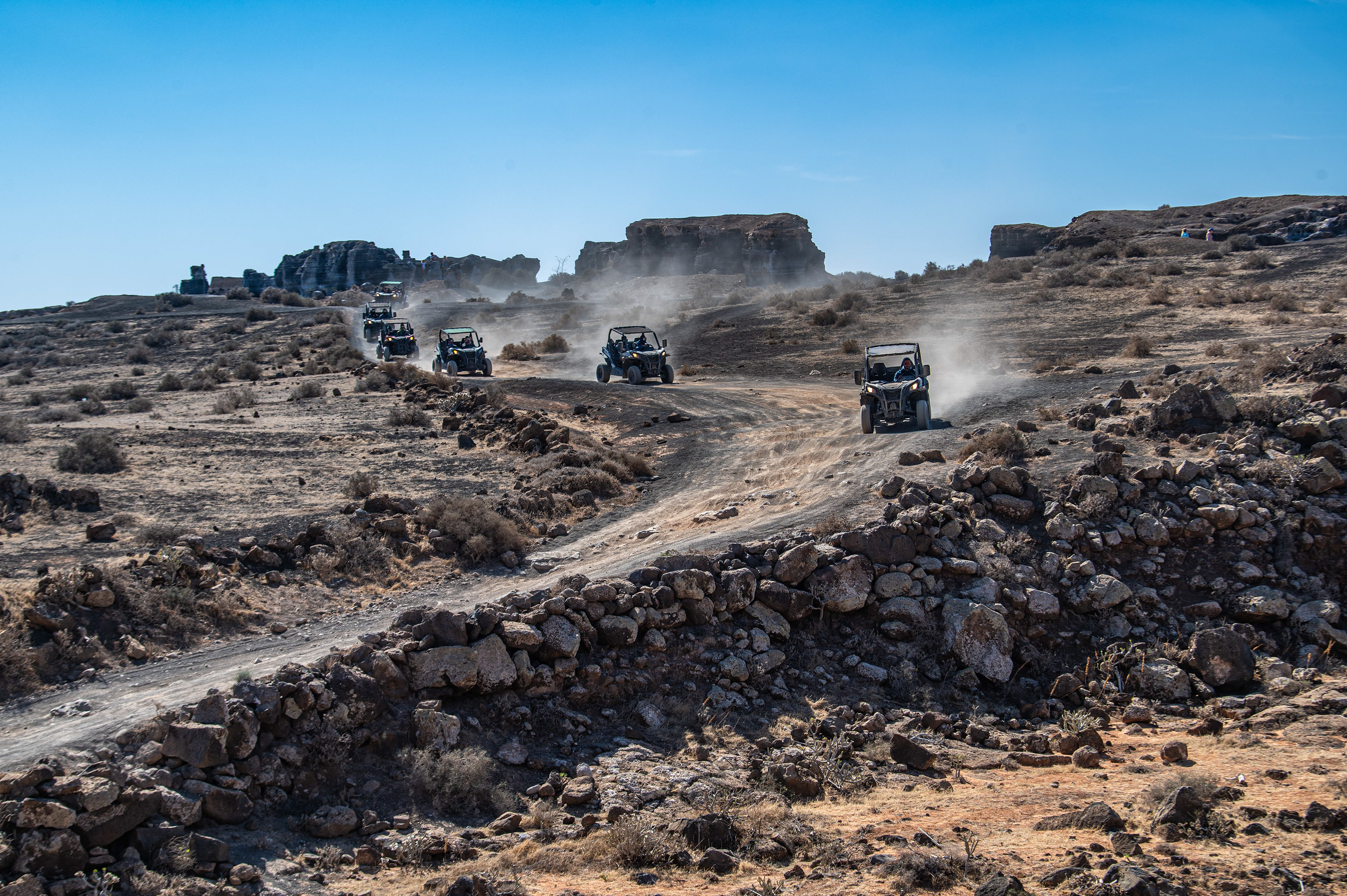
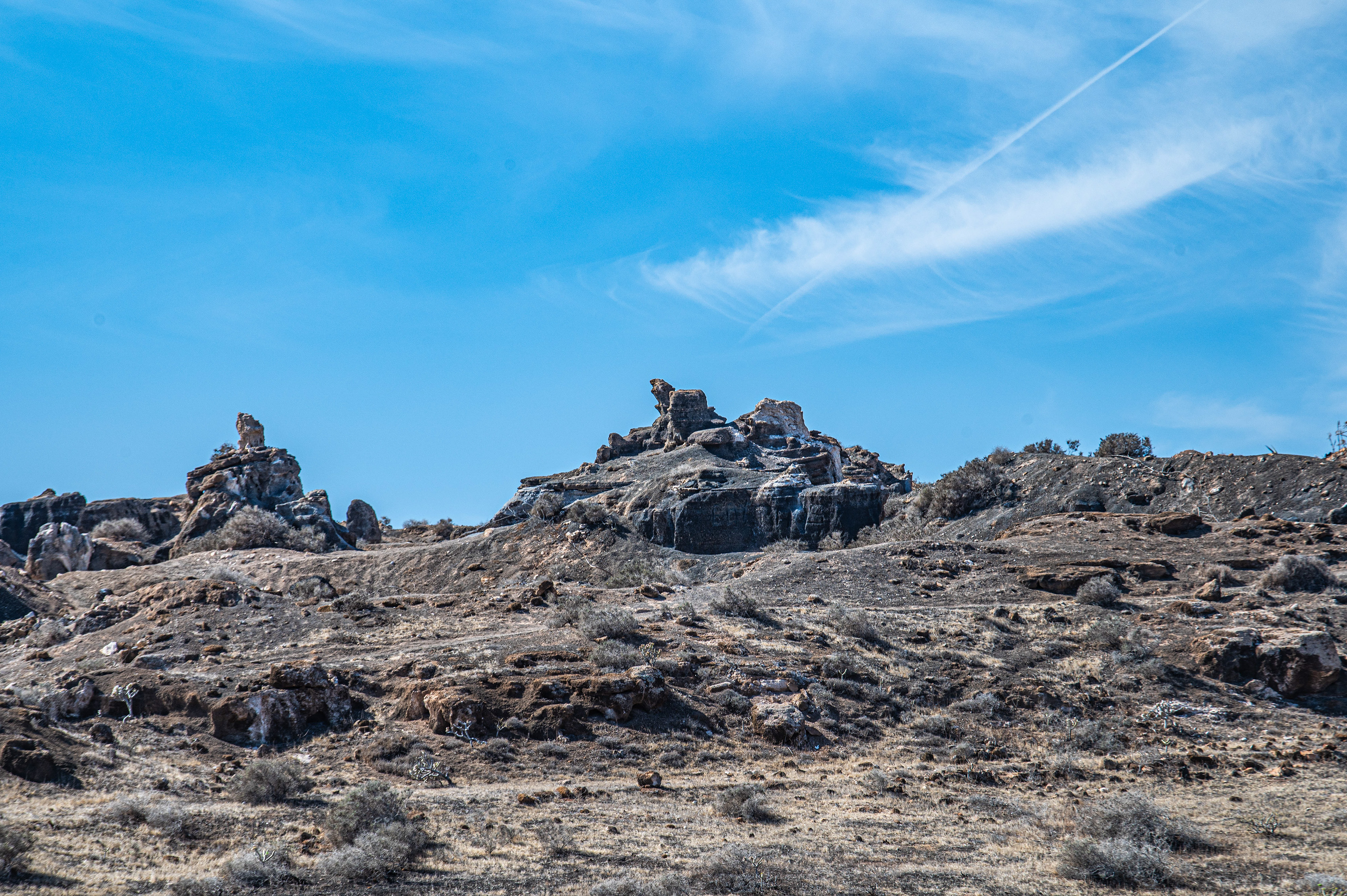
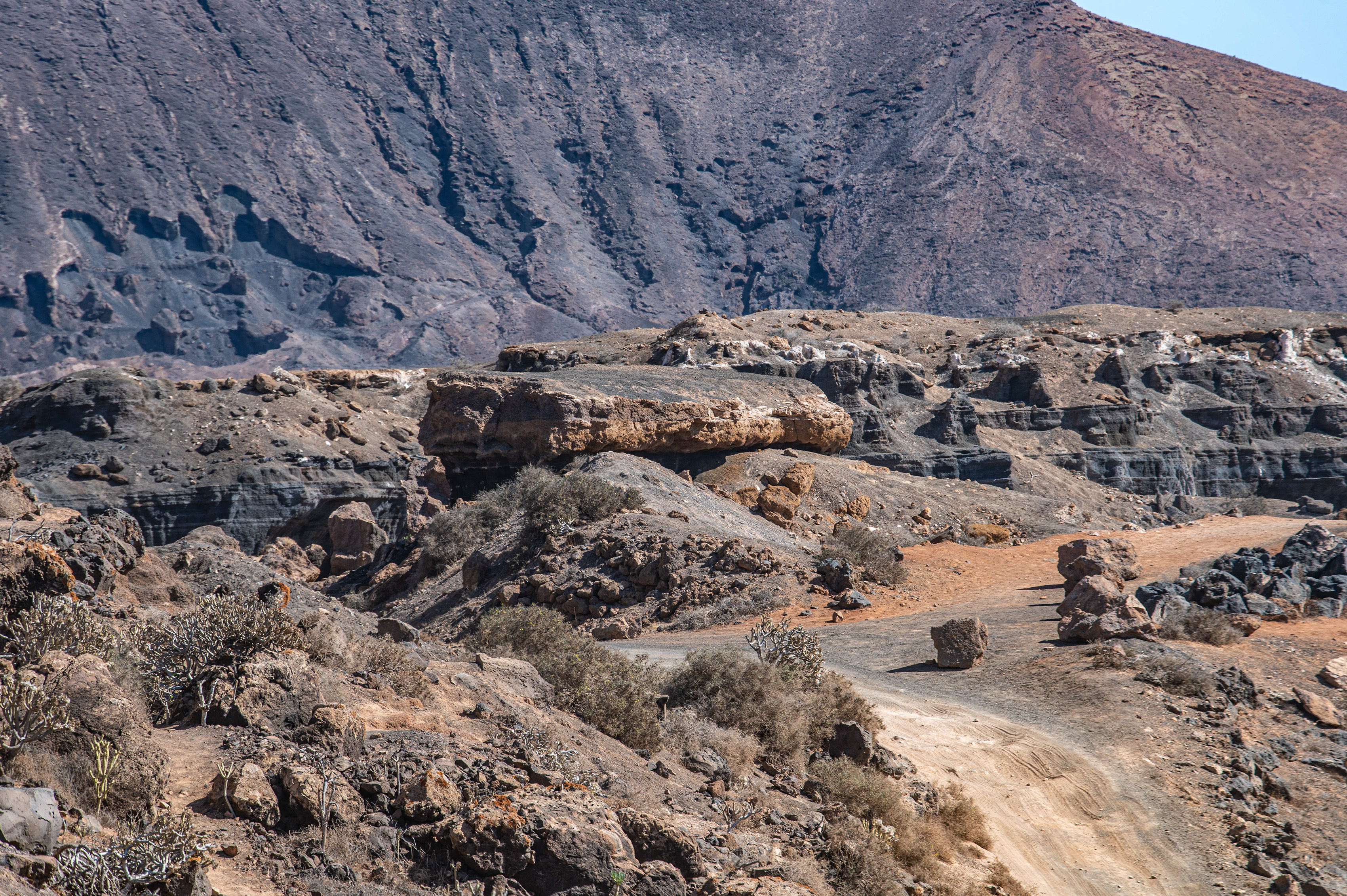
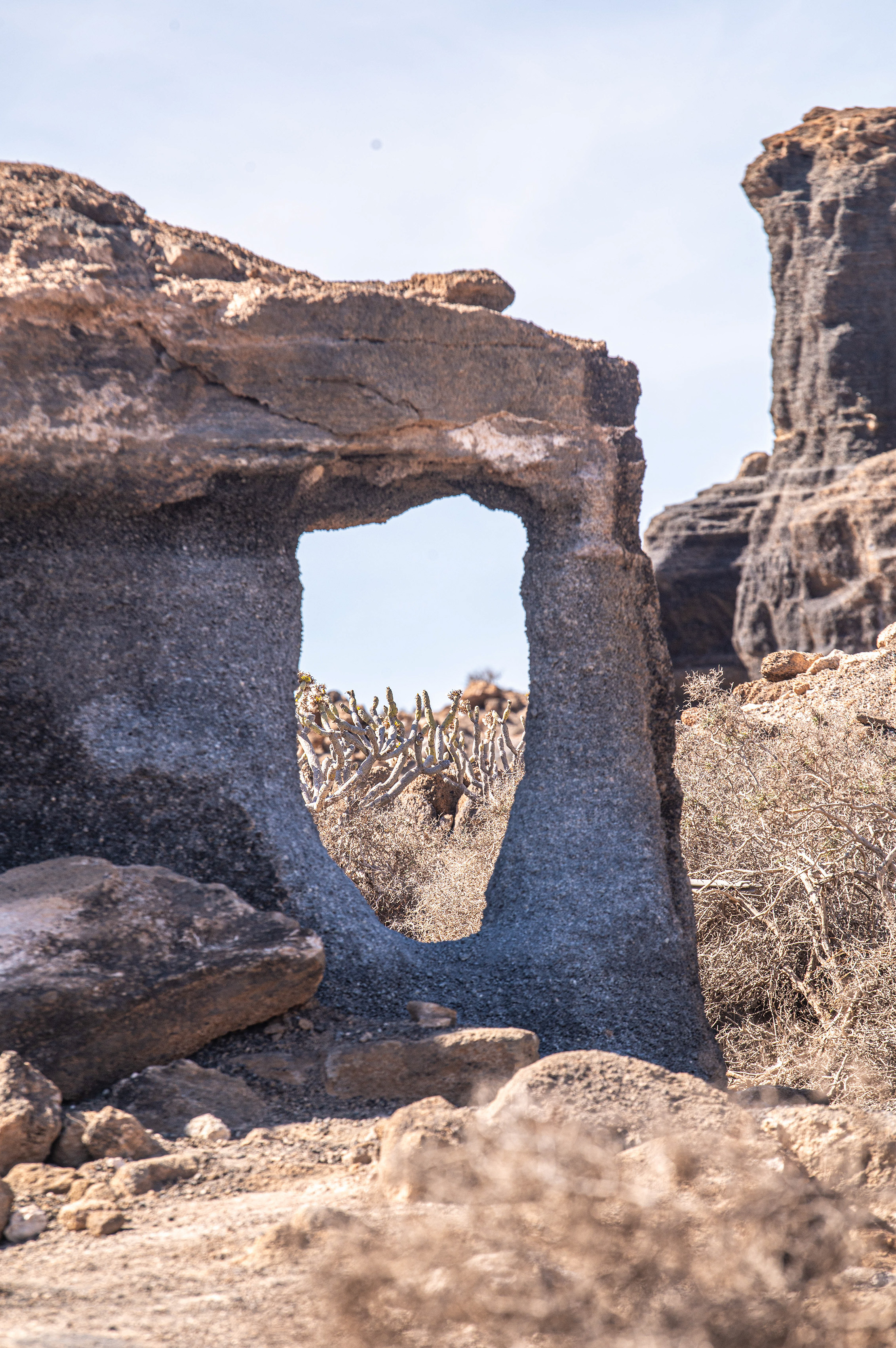
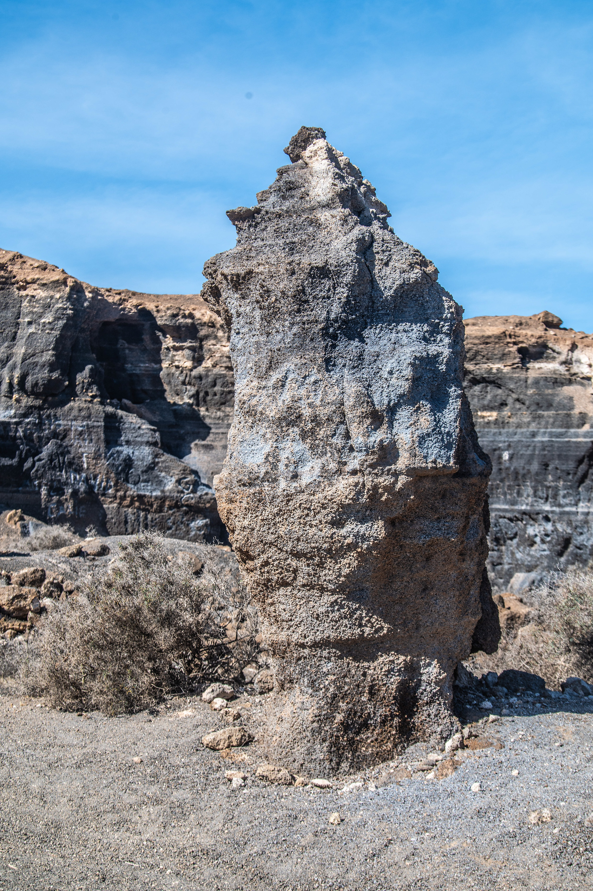
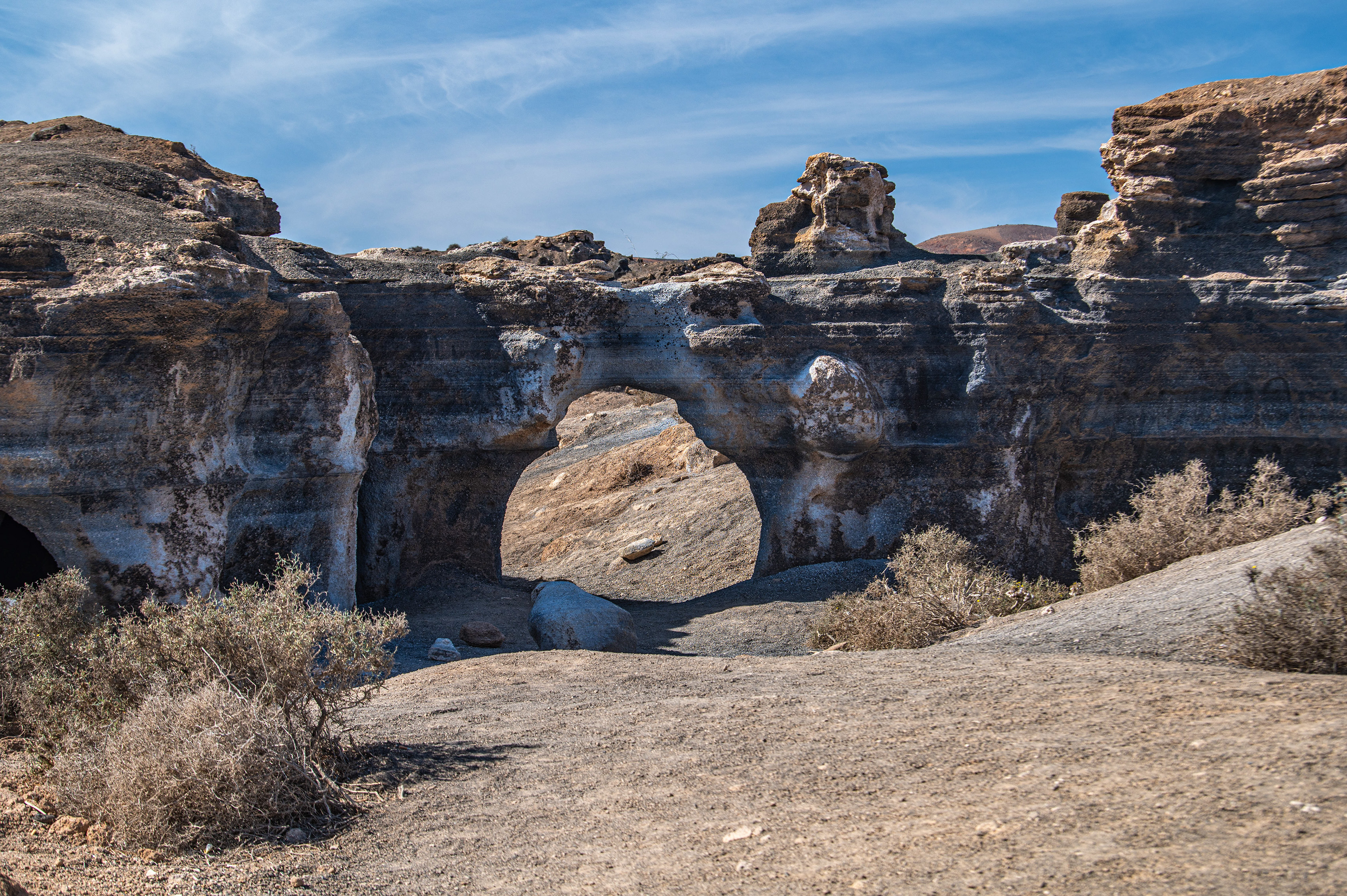
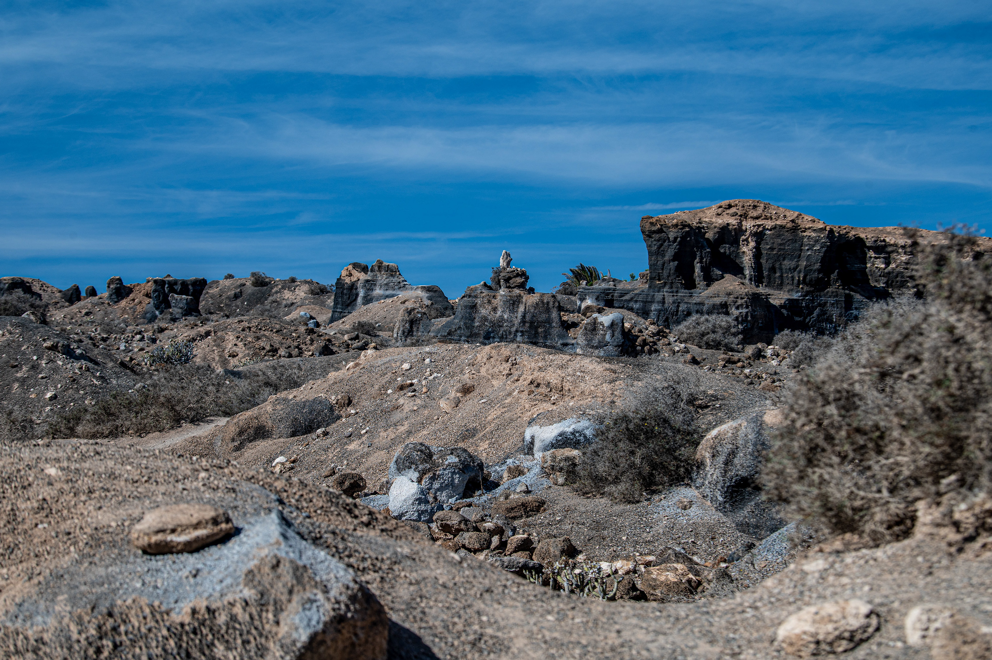
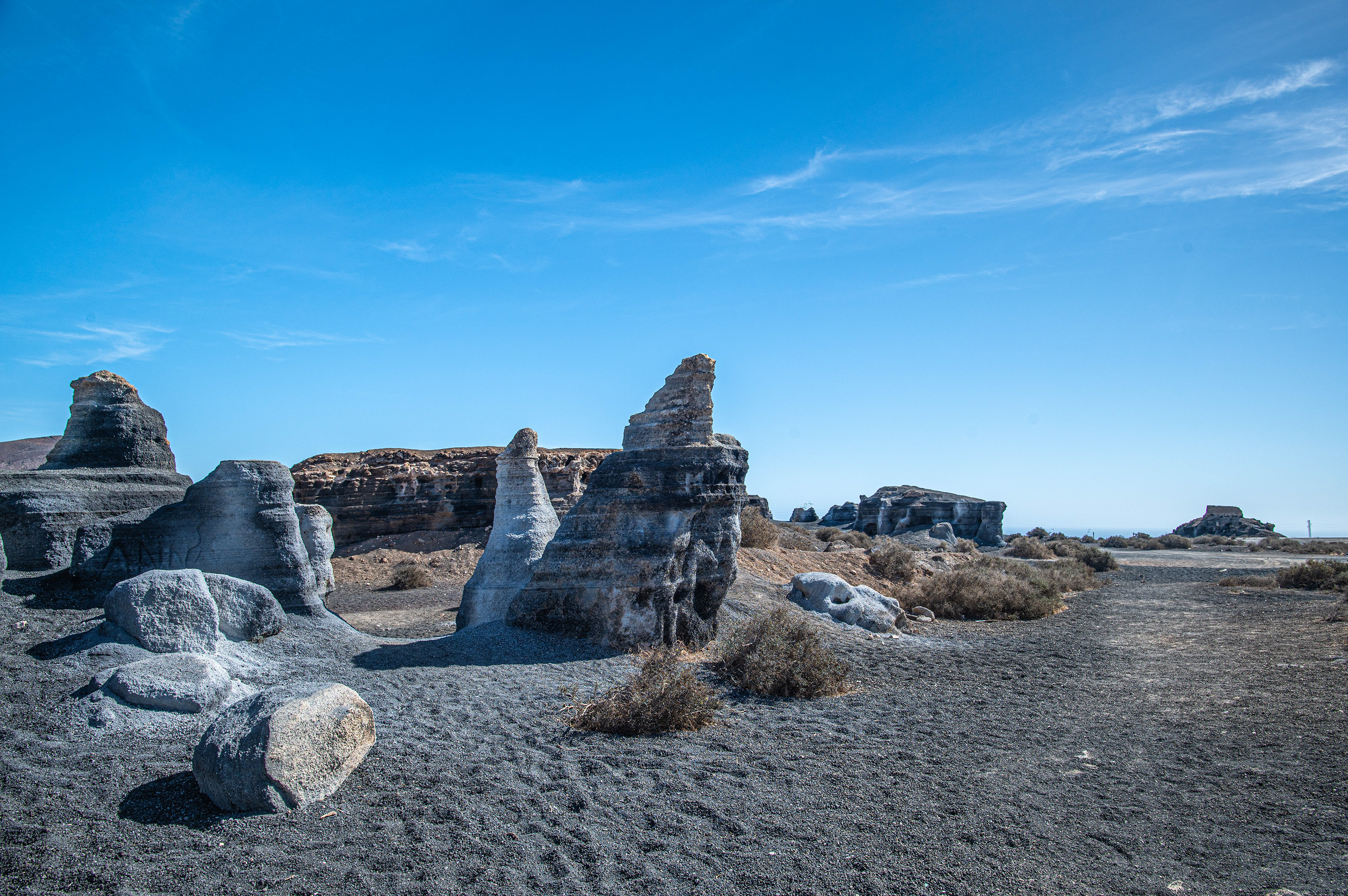
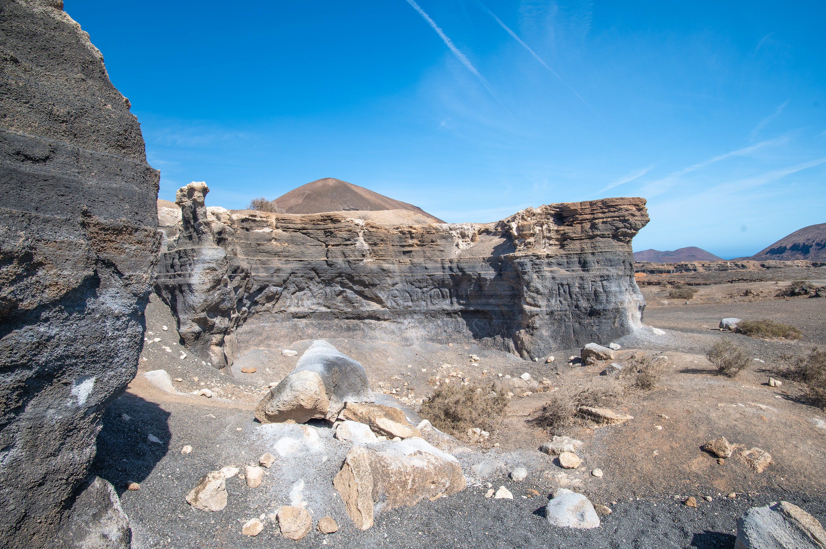
Ciudad Estratificada (Los Roferos) is an informal name for an abandoned stratified quarry near Teseguite in northern Lanzarote, noted for its dramatic, wind-sculpted volcanic ash and tuff formations that resemble a ruined, layered city. It’s a free, roadside attraction popular with photographers and short-stop visitors.

Geology and what you’ll see

Rock type: Weathered volcanic ash and lapilli (picon) that has eroded into arches, columns, caves, and thin stratified layers.
Formation process: Long-term wind and rain erosion acting on the quarry’s soft volcanic deposits produces the “otherworldly” shapes and constantly changing surfaces.

References

canariaslovers.comwww.solosophie.com , Text generated by Microsoft CoPilot

Mirador del Río

Carretera YéHaríaLanzarote,   Spain

a beautiful coastal area with clear blue waters and a volcanic landscape
a beautiful coastal area with clear blue waters and a volcanic landscape ‐ photo by ,
©www.mgaylard.co.uk.
a rugged, rocky coastline with a steep cliff descending to a small, secluded beach
a rugged, rocky coastline with a steep cliff descending to a small, secluded beach ‐ photo by ,
©www.mgaylard.co.uk.
a rugged, arid landscape
a rugged, arid landscape ‐ photo by ,
©www.mgaylard.co.uk.
a rugged, rocky cliff face against a clear sky
a rugged, rocky cliff face against a clear sky ‐ photo by ,
©www.mgaylard.co.uk.
salt pan
salt pan ‐ photo by ,
©www.mgaylard.co.uk.
a sense of natural beauty and ruggedness
a sense of natural beauty and ruggedness ‐ photo by ,
©www.mgaylard.co.uk.
a communication tower or antenna
a communication tower or antenna ‐ photo by ,
©www.mgaylard.co.uk.
the background features distant mountains shrouded in mist
the background features distant mountains shrouded in mist ‐ photo by ,
©www.mgaylard.co.uk.
Open the full set flickr button this page

Mirador del Río

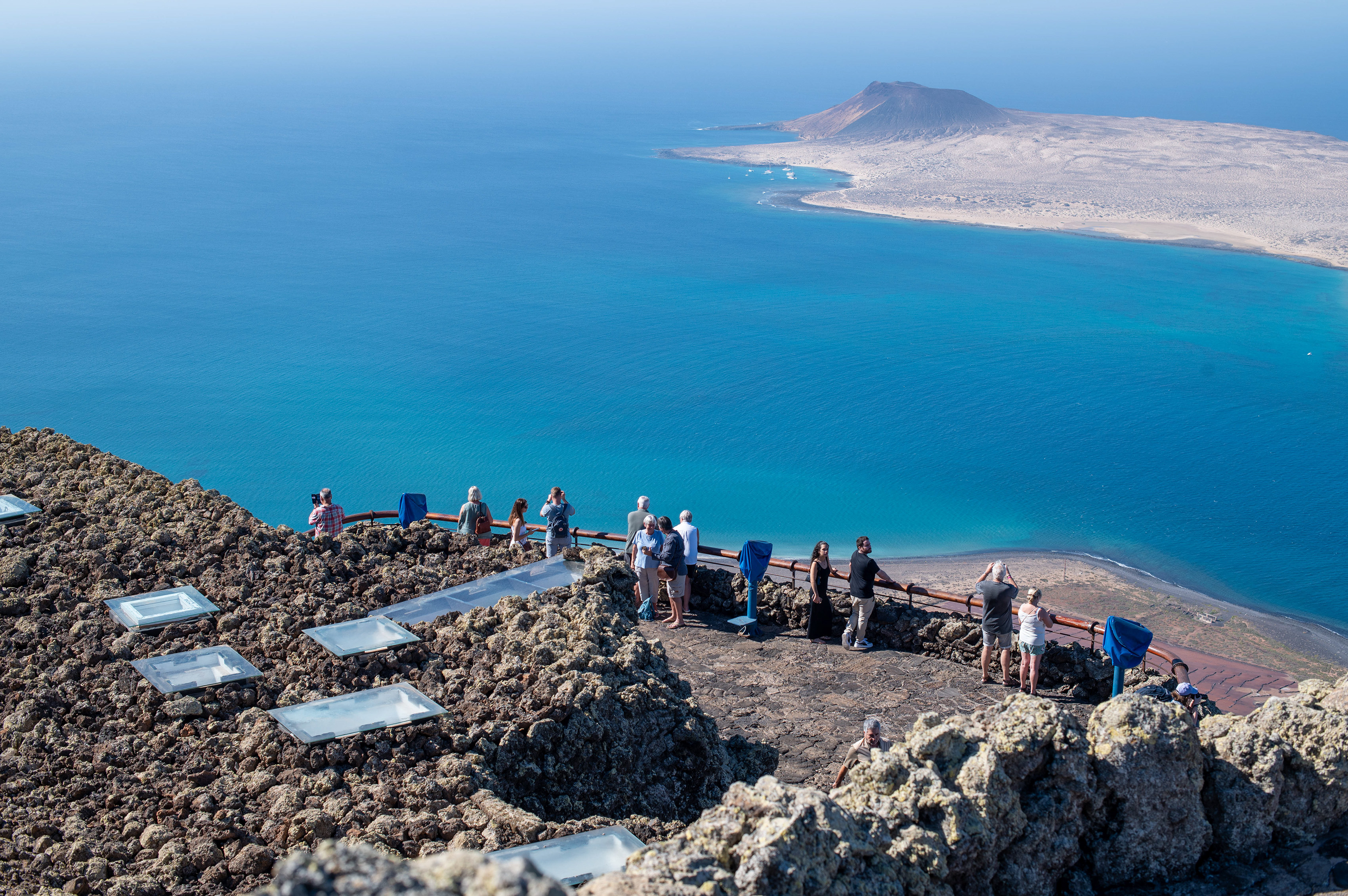
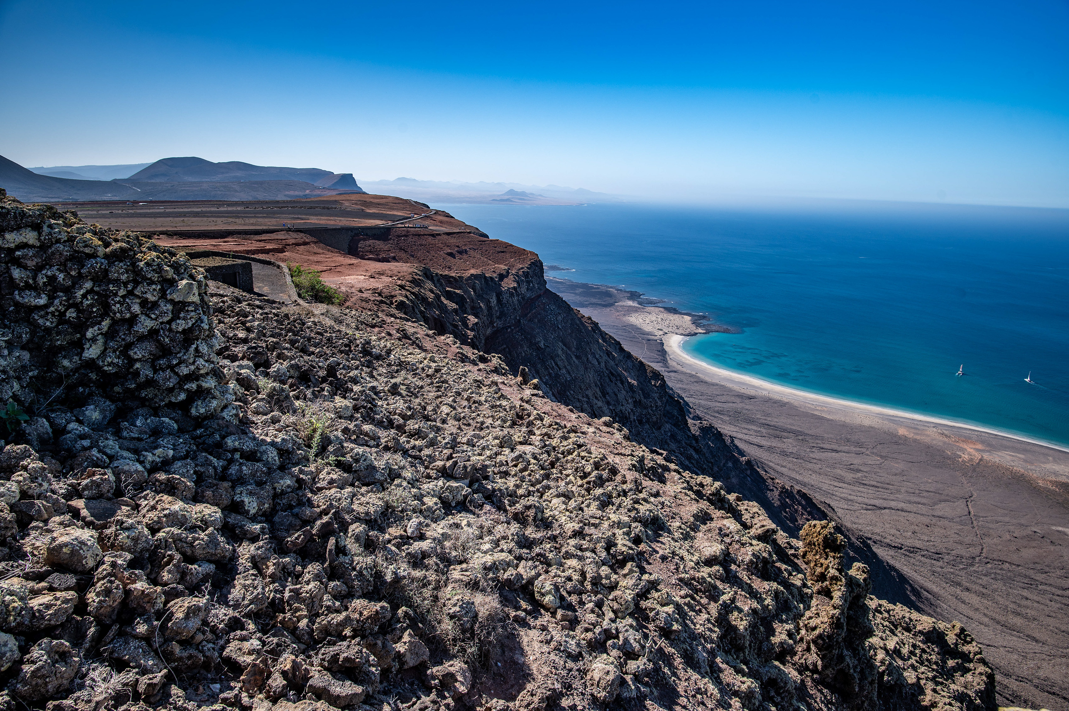
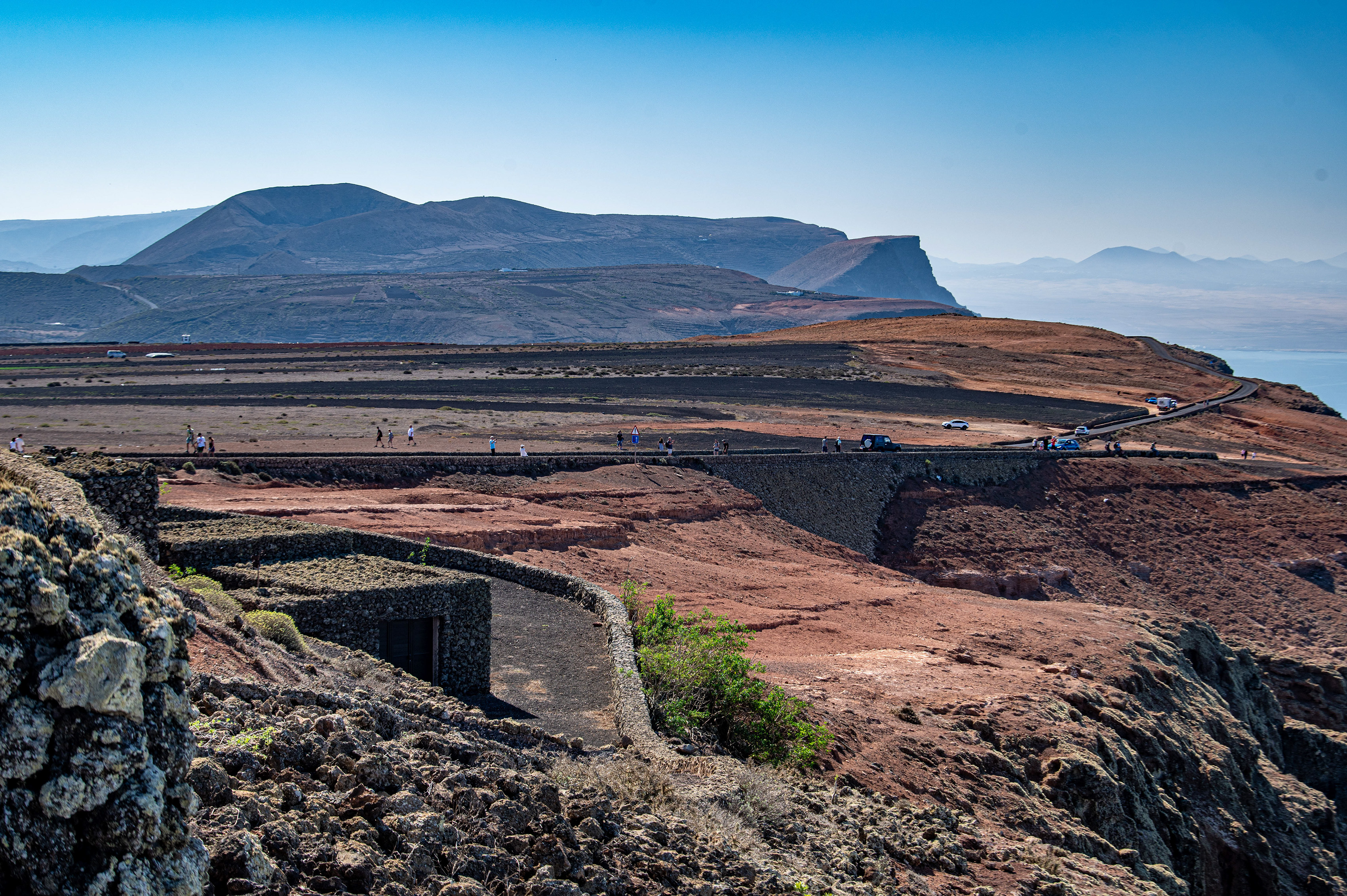
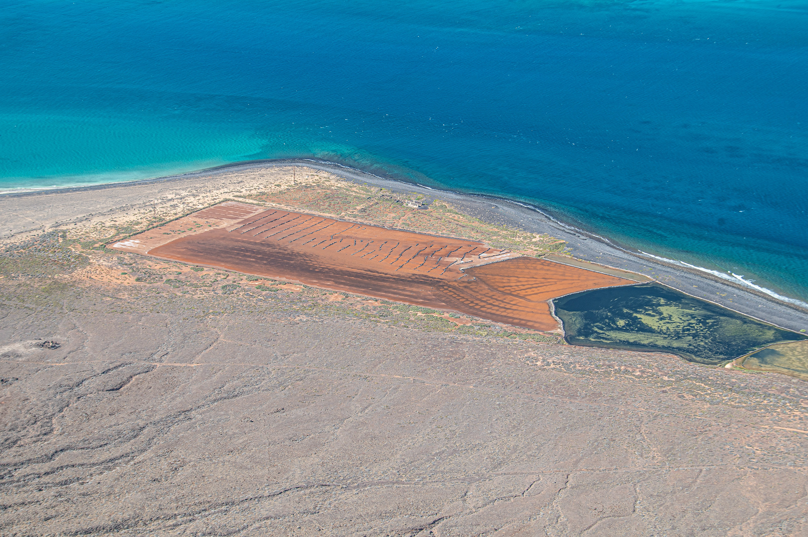
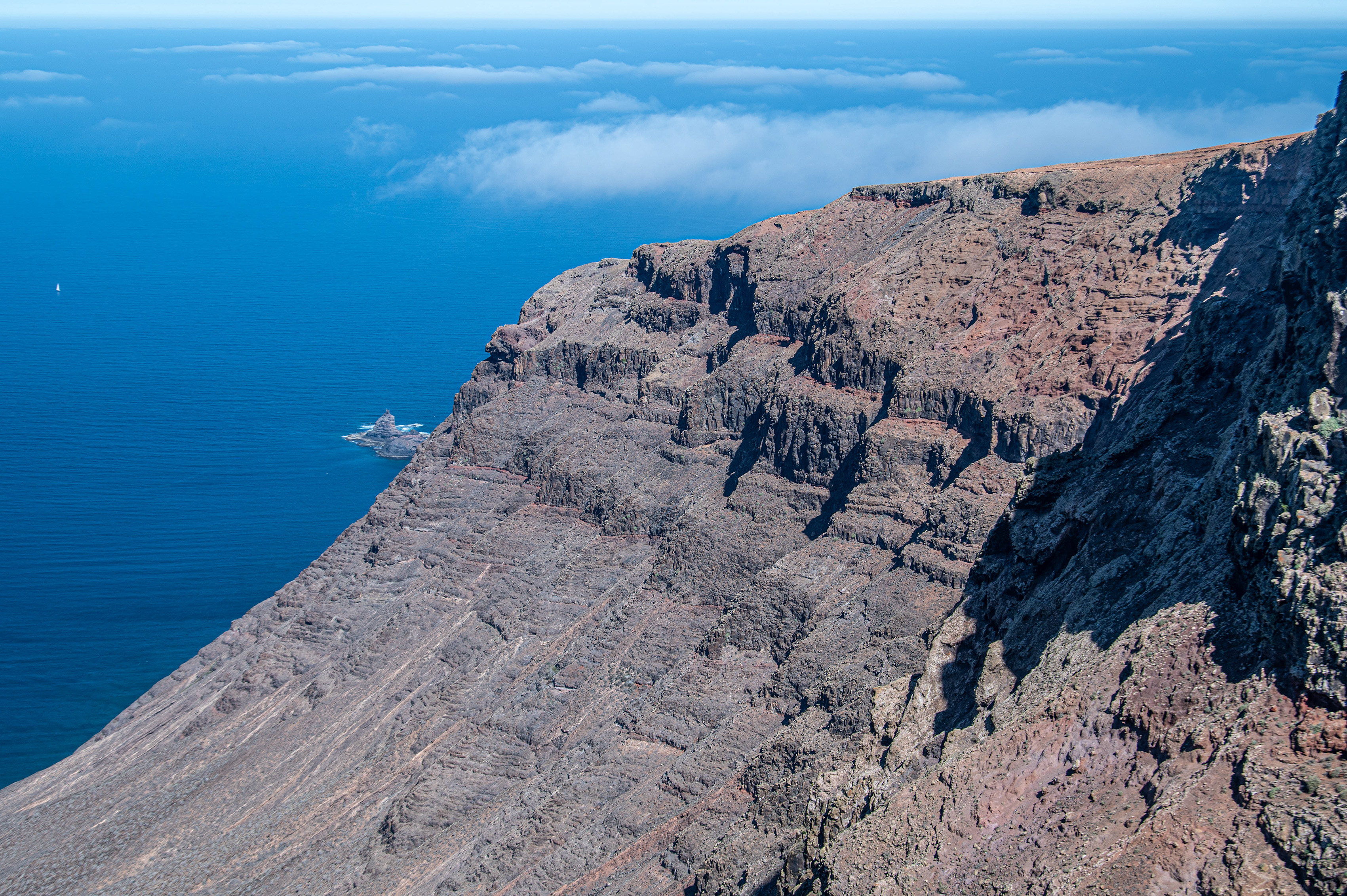
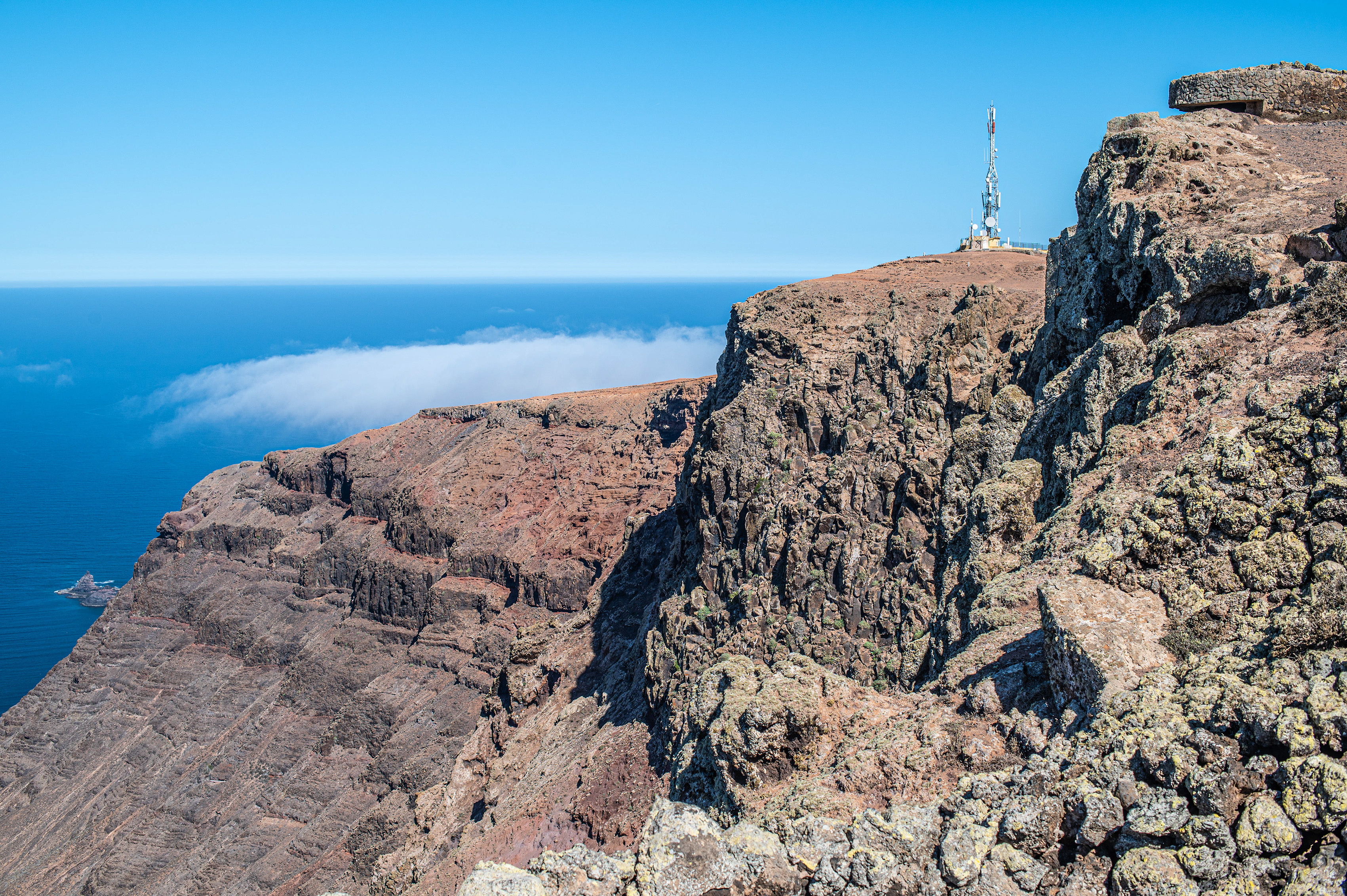
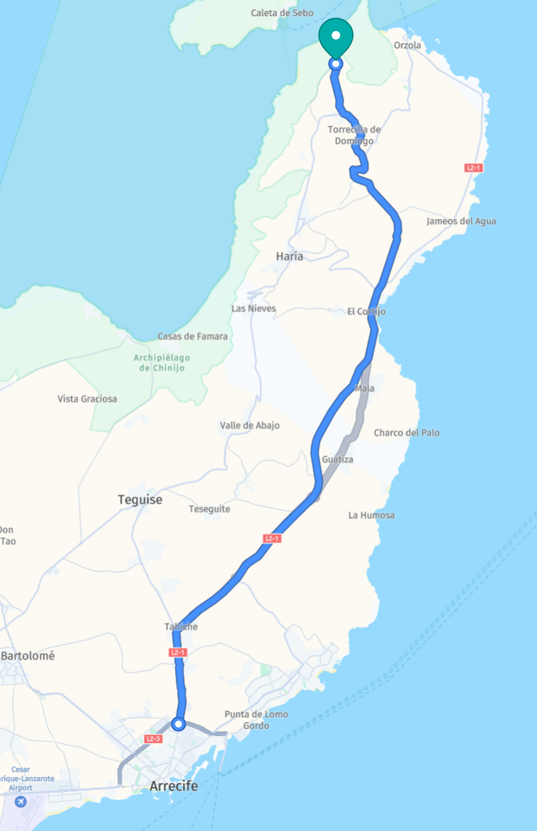
Mirador del Río is a dramatic cliff-top viewpoint carved into the volcanic rock of the Famara escarpment that frames panoramic views across the narrow sea channel to La Graciosa and the Chinijo Archipelago. It was conceived and built by Lanzarote artist-architect César Manrique, who integrated the building into the landscape so it appears to grow from the rock.

What to see on site

  • Interior circular viewing rooms with framed windows that focus on La Graciosa and the sea.
  • Exterior balcony and walkway that open onto sweeping seascapes and the Salinas del Río salt pans.
  • Upper terrace reached by a spiral staircase for the most complete panorama.
  • Restaurant integrated into the mountain — designed to blend with the terrain and often recommended for the view as well as food.

References

canaryislandsinfo.co.ukwww.lanzarote.comen.wikipedia.org , Text generated by Microsoft CoPilot
To the top
Powered by w3.css. The images are all stored on link to www.gaylard.co.uk Photostream on Flickr   This website is hosted by link to 123Reg Web Hosting